Hydromagic Survey is a professional hydrographic survey package. The affordable and easy-to-use software has a short learning curve to use for mapping area depths using an echo sounder.
Hydromagic Dredging is a dredge monitoring package which allows you to monitor and record dredging depths of your cutter, suction or backhoe dredge. Use data from a wide range of motion, inclinometer and bubbler sensors.
A free demo version package, containing both the Hydromagic Survey and Hydromagic Dredging programs, is available for free on Eye 4 Software’s download page.
Start learning to use Hydromagic Survey now and start creating your first sounding within a single day.
Features
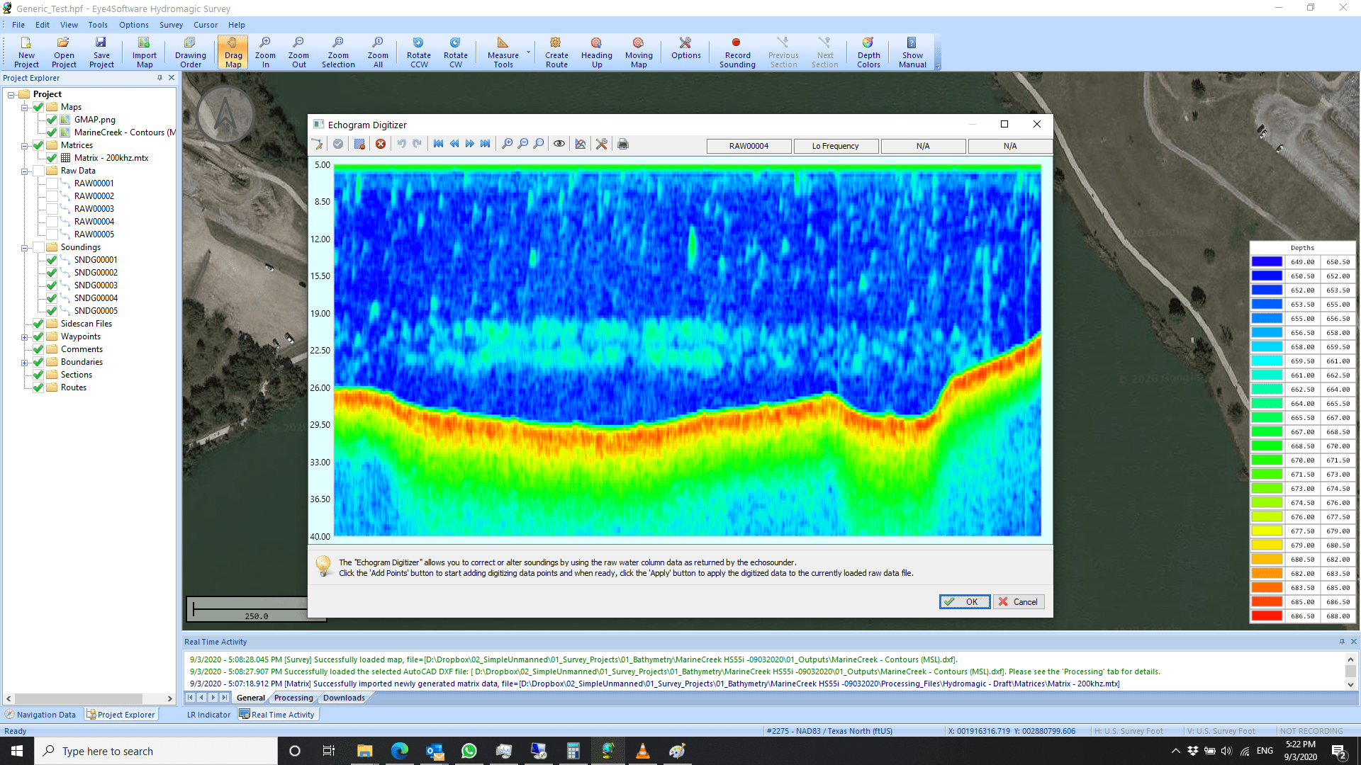
Built-in raw data editor
Correct your raw data with echogram editor, position editor, filtering, PPK processing, latency correction and more
Generate Depth Contours as Map Overlay
Generate one or more depth contours as a map overlay. Export map contours in either AutoCad DXF or Google KML files
Regularly Spaced Matrices with TIN
Generate regularly spaced XYZ data (matrices) using triangulation and interpolation (TIN)
Channel Designs and Cross Sections
Create channel designs and show and export channel cross sections;
Digital Terrain Models
Calculate volumes using DTM’s (Digital Terrain Models) or cross-sections
Tide Corrections
Automatic (RTK) or manual tide correction
Built-in Map Downloading Tool
Download maps for the survey area from Google Earth, Bing Maps or OpenStreetMaps
Incoming Information Dataview
Dataview to display all incoming information retrieved from GNSS, echo sounder and other sensors
Import Side-scan Sonar Data
Import side scan sonar data files and use them as background map or map overlays
Monitor Dredging Depth of Dredger
Use the Hydromagic Dredging software to monitor the dredging depth of your cutter, suction or backhoe dredger
Applications for Hydrographic Survey Software
Hydromagic is an affordable and easy-to-use software package for hydrographic survey projects. It is designed for:
- Performing hydrographic surveys
- Positioning vessels or barges for dredging projects
- Volume calculations of basins, ponds or river sections
- Volume calculations between dredge operations
- Navigating on ECDIS maps, or in the fishing industry to navigate into fishing parcels
Hardware
Install on any desktop, laptop or netbook computer running Microsoft Windows from Windows XP with service pack 3 or higher.
Compatible with a wide range of hardware, including a simple fishfinder and GPS device to a hydrographic echosounder with an RTK receiver.